Topo Maps Canada app for iPhone and iPad
4.0 (
5200 ratings )
Travel
Navigation
Developer:
DC Cloud Apps, LLC
Free
Current version:
6.4.2, last update: 9 months ago
First release : 23 Sep 2010
App size: 10.79 Mb
Download and view topographic maps covering Canada.
Topographic maps are useful for recreational activities such as hiking, canoeing, camping, fishing, mountain biking, geocaching, and exploring.
MAPS
Choose from 3 map sources: Canada Base Map (shaded/unshaded), and Toporama.
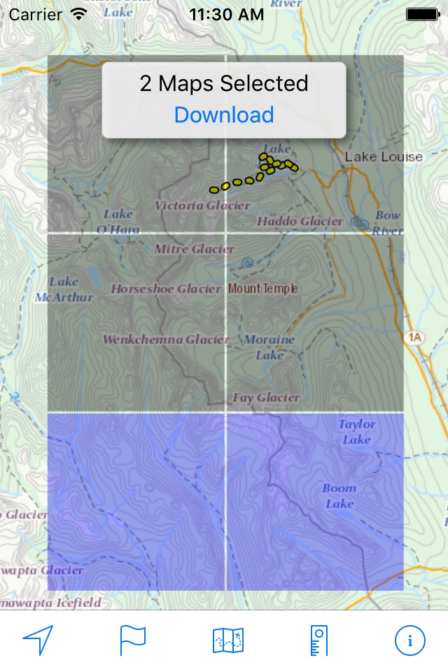
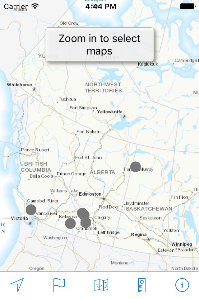
OFFLINE
Download maps for areas of interest to view them later when you dont have Internet access or you dont want to use cell data.
TRACKING
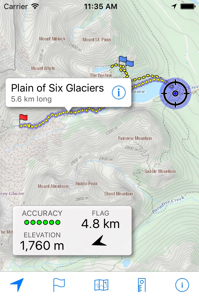
Use location tracking to show where you are on the map, your elevation, and the accuracy of the GPS signal.
FLAGS
Flags are included with map downloads. Add flags (waypoints) to the map to mark your current location or other locations. Import flags from other sources using GPX files and geocache LOC files. Share flags with others using email or AirDrop. Organize your flag types by color, for example, geocaches, trailheads, and summits.
TRAILS
Trails are included with map downloads. Import trails (tracks) using GPX files you find on the Internet or from your personal GPS track collection. Share trails with others using email or AirDrop. Organize your trail types by color, for example, mountain bike trails, hiking trails, and OHV trails.
TRAIL RECORDING
Record your own trails to show where youve been on the map, follow them later, and share with others.
ELEVATION PROFILE
Recorded trails include an elevation profile (distance/elevation chart).
NAVIGATION
Navigate to a flag by following the direction arrow that uses your compass heading. Useful for geocaching.
MEASURE
Measure the distance between points on the map.
Note: Continued use of GPS running in the background can dramatically decrease battery life.
Pros and cons of Topo Maps Canada app for iPhone and iPad
Topo Maps Canada app good for
The app is really helpful. Thanks! Might it be possible to show the current GPS data and the coordinates of the marker on the map?
Awesome topo maps for all around.
Only thing I find lacking is not being able to scroll when in locate mode. Other than that, an adventure backpackers BFF.
One drawback - some coastal areas peppered with the name of an island group on each small island obscuring topographical features, otherwise innovative and pleasant to use.
This is a great app! Cant wait to get my new off road vehicle out into the countryside!
This app works perfect now i can have a map handy when cell service is not available.
The only thing i miss is a legend with seems to be so and easy thing to add.
If you like hiking in remote area, it is the app for you, download the maps of the area you need in advance then no need of a cellular signal! It is an amazing tool for Canadian hikers
Some bad moments
List of maps in previous version much more useful than lid of trails.
Ruler not as accurate in distance and bearing in this version and It does not allow for measuring long distances across many maps and or screens.
How can I get rid of this version and go back to version3.2.2
I parrot zcals review. Im in BC and what he said about Ontario can be said here too.
Glad I was not required to pay for it.
Better than no map at all. But doesnt replace a decent topo map on paper, alas. Not very detailed. And it seems to harder to use and requires you download all these little maps now. You might do better with plain old Google Maps - in some respects you can get much more detailed information from there, which isnt saying a lot.
I tried to postpone updating this App but unfortunately it updated automatically when I upgraded my iOS. I’ve used it on someone else’s phone and hated it. Dislikes about the new update:
-Can’t zoom out anymore without it going to the download maps screen which darkens the whole map. When we are out in the mountains, being able to zoom out is needed. It allows us to see and measure how far away our destination is. (IE. can no longer measure the distance from starting trailhead to Mt. Assiniboine)
-Ruler tool. You can no longer measure long distances, it only works within the area of the map thats on your phone.It’s impossible to get the distance of travel from point a to b.
-The “Find Me” feature glitches
PLEASE bring the old ruler back and the zoom out feature. They’re soo useful in the mountains.
Been years since I had this app installed. Still outdated maps. How outdated? The railway near my house has been torn up to make a hiking trail and neither the trail not the tracks are on the map.
Usually Topo Maps Canada iOS app used & searched for
offline topo maps,
topo maps,
topographic maps,
geocaching canada,
and other. So, download free Topo Maps Canada .ipa to run this nice iOS application on iPhone and iPad.